
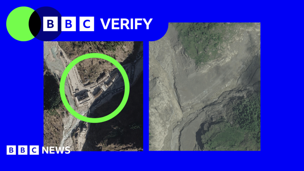
This destructive path continues westwards along with the swelled river, before heading southwards. Satellite images also show the formation of a barrier lake at the base of the landslide’s path, which Chinese authorities have warned poses a major risk of further flooding and has hampered rescue efforts. Dr Argha Banerjee, a glaciologist at the Indian
This destructive path continues westwards along with the swelled river, before heading southwards.
Satellite images also show the formation of a barrier lake at the base of the landslide’s path, which Chinese authorities have warned poses a major risk of further flooding and has hampered rescue efforts.
Dr Argha Banerjee, a glaciologist at the Indian Institute of Science Education and Research, told BBC Verify that it was not possible determine from the images how stable the barrier was or how likely the lake was to drain suddenly.
But he said there was no significant increase in its surface area between Wednesday and Thursday, despite water continuing to flow into the lake.
Dr Banerjee said there was a visible drainage channel, which suggests some water was already escaping downstream, adding that the its volume was “not alarmingly large” and appeared to have stabilised.
The extent of the damage on the Tibetan side of the border remains unclear. It is a strictly controlled region which China annexed in the 1950s, where foreign media access is heavily restricted. BBC Verify has so far been unable find verifiable footage from the area.
The satellite imagery – which only provides an initial glimpse into the damage of the flood – has been published by Vantor as part of its Open Data Program to help aid authorities establish where best to focus their efforts to locate the missing, rescue survivors and recover the dead.
Additional reporting Shruti Menon, Merlyn Thomas and Alex Murray. Graphics by Mezut Ersoz.
For more tech updates, stay tuned to our blog.