It’s a confusing time when a hurricane threatens, and some terms used by officials aren’t known by everyone, so here’s a storm glossary. Let’s start with the broad category of these storms, called tropical cyclones. In the northern hemisphere, a tropical cyclone is a rapidly counterclockwise-rotating storm that forms in Earth’s warmer areas that is
It’s a confusing time when a hurricane threatens, and some terms used by officials aren’t known by everyone, so here’s a storm glossary.
Let’s start with the broad category of these storms, called tropical cyclones. In the northern hemisphere, a tropical cyclone is a rapidly counterclockwise-rotating storm that forms in Earth’s warmer areas that is organized with a center that winds flow out of. Tropical cyclones rotate clockwise in the southern hemisphere.
The strongest tropical cyclones in the Atlantic and eastern and central Pacific oceans are called hurricanes. In the northwest Pacific they are called typhoons and in the south Pacific and Indian oceans they are called cyclones or tropical cyclones.
In the Atlantic, the weakest of these systems are called tropical depressions. They have winds of less than 39 mph (63 kph).
When a tropical depression reaches 39 mph (63 kph) but is weaker than 74 mph (119 kph) they are called tropical storm and receive a name from a pre-established list.
When a tropical storm hits 74 mph (120 kph), it achieves hurricane status. There are five categories of hurricanes based on maximum sustained winds speed in a rating system called the Saffir-Simpson Scale.
The weakest is a Category 1, with winds of 74-95 mph (120-150 kph) and it will have dangerous winds that produce some damage. Tree branches will snap and some will be uprooted. Extensive power damage is likely.
A Category 2 has winds of 96-110 mph (155-175 kph) and can be disastrous, with near-total power loss expected near the center.
When hurricanes sustain winds exceeding 111 mph (180 kph), they get major hurricane status, with devastating consequences. Even well-built homes may be severely damaged by a Category 3 hurricane with winds of 111-129 mph (180-210 kph).
A Category 4 hurricane is considered catastrophic, with winds of 130-156 mph (210-250 kph) that leave entire areas uninhabitable for weeks or months.
The scale tops out at Category 5, when a hurricane’s winds exceed 157 mph (250 kph). A high percentage of the homes in the disaster region will be destroyed. Power outages could last for months.
Storm surge is the deadly rise of water generated by a storm that’s above and beyond the normal tide. It starts in the ocean but could include rivers and canals. Storm surges once caused nearly half of a hurricane’s deaths, but surge-related fatalities have come down with warnings and education to about 11% of all direct deaths. Surges can reach as much as 20 feet or more and that does not include waves, which are on top of storm surge.
Storm tide is storm surge plus tides.
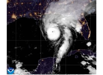
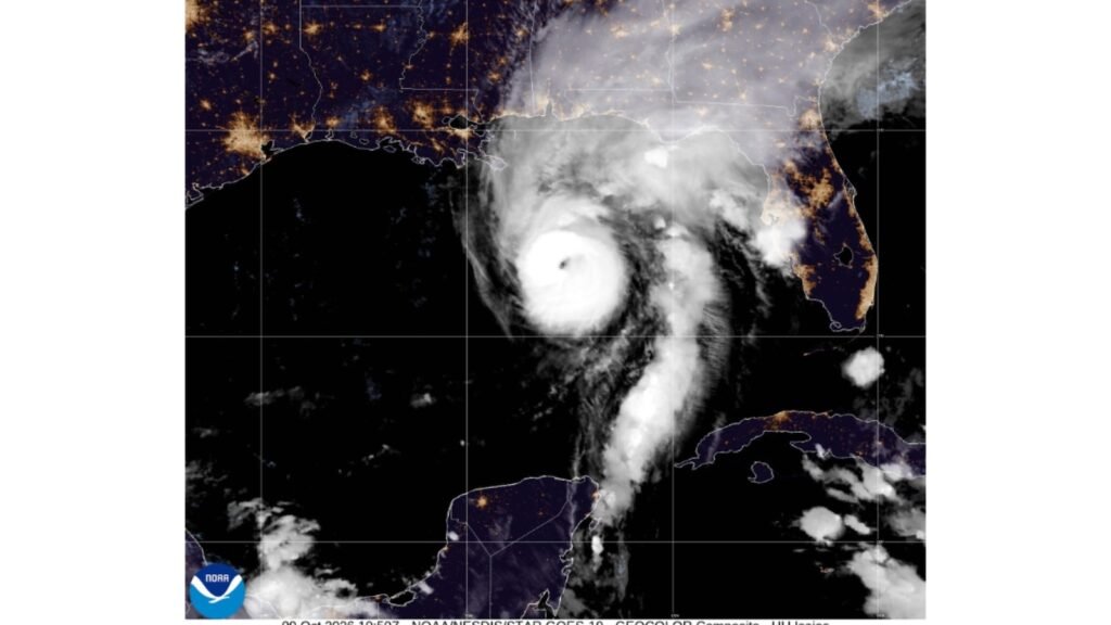
A hurricane’s center is called the eye. It is calm inside the eye, but it is crucial to the storm’s formation and continuation. It is circular and is usually 20 to 40 miles (30 to 60 km) in diameter, but can be bigger. The smaller the eye is, the stronger the storm. After awhile, a storm can form a new second eyewall around the first in a process called eyewall replacement that temporarily weakens the storm’s intensity but enables it to grow larger overall.
The outside of the eye is the eyewall and it is the storm’s most dangerous area with the strongest winds. When an area on the ground is hit by the eyewall, it will be buffeted by intense winds, then get a break before being slammed by the other side of the eye in a second round of the storm’s strongest winds.
When the eye of a hurricane or tropical storm goes over land, that point is called landfall. But high winds, rain and storm surge can cause all sorts of damage many hours before landfall, and last many hours thereafter. Landfall is not necessarily where the strongest winds are, and the wider swirl of a storm can spread destruction across large areas.
The right front quadrant of a hurricane or northeast part of the eyewall tends to cause the most damage as the strongest winds blow counterclockwise around the center, so this at times is called a storm’s dirty side. In the southern hemisphere, it’s the left front quadrant that is the dirty side.
There are dozens of computer generated models that forecast changes in each storm’s track and intensity. They vary because each one uses different assumptions about how storms operate and some prove better during certain storms and worse during others. Forecasters advise to avoid concentrating on one individual model. When many or all of the models are put on one map, they generally show an overall sense of what will happen. Sometimes they show a lot of lines going in different directions, which can look like cooked spaghetti.
The National Hurricane Center’s official forecast is not one specific line, but rather a cone of uncertainty that expands with time, up to five days out. That cone shows the most probable area where the eye of the storm could move over time, but it doesn’t mean the storm will be in the center of that cone. It is designed so that 67% of the most likely tracks fall within the cone.
A hurricane or tropical storm watch means conditions are possible within an area during the time specified by the National Weather Service. A hurricane or tropical storm warning means those conditions are no longer just possible, but expected. One way to think about it: A watch is having the ingredients to bake a cake, while a warning comes when the cake is pretty much done.
Wind shear is a change in wind speed or direction, or both, and it can weaken a storm. Crosswinds at high levels, such as 40,000 feet (12,200 meters) above sea level, can often decapitate a storm. Wind shear also can describe when winds up at the top of the storm blow in different directions than at bottom or middle.
When a storm, usually fed by unusually warm water, suddenly gathers a lot of strength, sustaining winds that increase in speed by at least 35 mph (56 kph) in 24 hours, it is called rapid intensification. This is a dangerous situation if it happens close to land.
___
The Associated Press’ climate and environmental coverage receives financial support from multiple private foundations. AP is solely responsible for all content. Find AP’s standards for working with philanthropies, a list of supporters and funded coverage areas at AP.org.
For more tech updates, stay tuned to our blog.