We have all been caught out by a vague weekend forecast. You check your phone on a Saturday morning, see a generic prediction of possible showers across regional Victoria or coastal New South Wales, decide to wash your car or plan a road trip, and within two hours a rogue storm cell dumps rain straight
We have all been caught out by a vague weekend forecast. You check your phone on a Saturday morning, see a generic prediction of possible showers across regional Victoria or coastal New South Wales, decide to wash your car or plan a road trip, and within two hours a rogue storm cell dumps rain straight over your roof.
The core issue has always been resolution and timing. Traditional global weather models look at the world through coarse grids and update only a few times a day. Google is looking to change that dynamic with WeatherNext 3, its latest flagship weather forecasting model developed by Google DeepMind and Google Research.
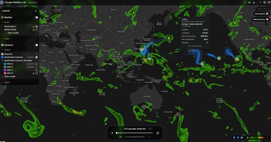
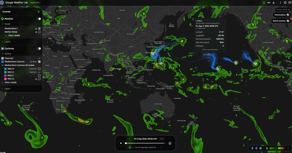
The model is now rolling out across Google Search, Google Maps, the Gemini mobile app, and enterprise cloud tools. It brings three major upgrades to your pocket: fresh forecast updates generated every single hour, a tight five-kilometre spatial resolution, and precipitation predictions that Google claims are up to 50 per cent more accurate at lead times of 24 hours or more.
How the technology works under the bonnet
To understand why this is a noticeable step forward, you have to look at how computer weather forecasting traditionally works. Most global systems rely on massive physics simulations running on government supercomputers. Because those mathematical equations take hours to crunch, the models typically ingest new observations and spit out a fresh global forecast only four times a day, roughly every six hours.
The previous generation, WeatherNext 2, operated on that same six-hour cycle and visualised the atmosphere on a 25-kilometre grid. If a storm was only five kilometres wide, the model essentially blurred it across the entire district.
WeatherNext 3 changes both the speed and the detail. It ingests live geostationary satellite mosaics and conventional atmospheric data to run 24 separate forecast cycles every day. The major runs at 00, 06, 12, and 18 UTC look out 15 days ahead, while intermediate hourly runs produce fast 48-hour tactical outlooks. Under the hood, a 64-member ensemble runs in parallel, giving probabilities of different weather scenarios instead of just guessing a single outcome.
On the visual map, key surface variables like temperature and moisture now resolve down to five kilometres. Broader surface fields sit at 10 kilometres, while higher atmospheric metrics like upper-level winds remain at 25 kilometres. Google calculates that this layered approach makes the local picture roughly five times sharper than before.
Training on real stations instead of physics simulations
The underlying architecture is built on a Functional Generative Network mesh transformer. Technical label aside, the important breakthrough is what Google fed the system during training.
Most early AI weather models learned how to predict weather simply by copying reanalysis grids produced by traditional supercomputers. They were essentially imitating physics software. WeatherNext 3 breaks that pattern by training directly on raw, sparse observation data collected from physical weather stations on the ground.
By learning from real-world station readings, Google found the model significantly reduced local temperature errors. In benchmark testing against independent ground stations, WeatherNext 3 improved short-range two-metre temperature accuracy by up to 30 per cent compared to WeatherNext 2, and by 40 per cent compared to the European Centre for Medium-Range Weather Forecasts (ECMWF) standard ensemble system.
“One of the main developments is for [WeatherNext 3] to go beyond what data most global AI models train on.”
Samier Merchant, Research Engineer, Google Research.
Tackling the hardest problem in weather
Rain has always been the toughest challenge for meteorologists. Sudden storm buildups and coastal showers happen quickly over narrow areas, meaning coarse physics grids often miss them entirely or spread the rainfall evenly over hundreds of square kilometres.
To give WeatherNext 3 better eyes on rainfall, Google trained it on NASA’s IMERG satellite precipitation system alongside proprietary radar reanalysis data.
In medium-range global testing, Google recorded Continuous Ranked Probability Score improvements of up to 60 per cent against IMERG, 30 per cent against US ground-radar grids, and 10 per cent against rain gauge stations at early lead times. For everyday users, Google translates that into a 50 per cent boost in rain forecast accuracy a day or two ahead.
Independent benchmarks on the Operational WeatherBench leaderboard by Brightband back up the model’s overall skill, showing that machine learning systems are now going toe-to-toe with traditional supercomputers.
What this means for everyday Australians
High-resolution regional weather modelling has traditionally been expensive. Running detailed physical weather simulations requires massive compute resources, which is why global models historically treated Australia and the broader Southern Hemisphere with coarse, broad-brush forecasts.
Deploying a free, hourly, five-kilometre global model changes the equation. Australians have already seen early examples of machine learning outperforming standard models. When ex-Tropical Cyclone Alfred tracked toward south-east Queensland in March 2025, DeepMind’s earlier GraphCast architecture accurately mapped long-range path projections days before several traditional physics models caught up. WeatherNext 3 now incorporates dedicated cyclone track tracking directly into its automated outputs.
At the same time, it is important to keep expectations grounded. Australia’s Bureau of Meteorology uses machine learning to assist with data calibration, but its public forecasts and official severe weather warnings remain anchored in physical dynamical models.
WeatherNext 3 is not an emergency alerting service, and it is not a replacement for official storm, flood, or bushfire warnings from the Bureau. Instead, it acts as a sharper digital intelligence layer inside the apps millions of Australians already open every day.
Practical benefits for farmers and renewable energy
The real value of WeatherNext 3 sits right between casual smartphone checks and heavy industrial use. For agriculture, a grain grower in regional New South Wales or Victoria gets a much tighter hourly view of localized rainfall windows before committing machinery to a harvest.
For the renewable energy sector, Google has built in direct support for clean energy variables. Rather than relying on generic ground-level wind speeds, wind farm operators can query 100-metre hub-height wind projections directly. Managers of solar farms can access surface solar radiation downwards, direct-beam irradiance, and distinct cloud fractions split across low, mid, and high altitudes.
“As the energy needs of Google, but [also] entire humanity, is increasing its energy needs, to make sure that we make renewable a very appealing opportunity is very important for us.”
Ferran Alet, Research Scientist, Google DeepMind.
Energy operators, developers, and data teams can pull these operational datasets directly through BigQuery and Google Earth Engine, or download the full 64-member ensemble from Cloud Storage in Zarr format without custom licensing barriers.
Where you will spot the changes
For most consumers, the rollout is happening behind the scenes in Google Search, Google Maps route pins, and the Gemini assistant.
When you ask Gemini whether an outdoor event is going to get rained out, or check the weather pin for a coastal town on Google Maps, the data powering that answer is now updated hourly from a 5km model rather than every six hours from a 25km grid.
“The atmosphere will always retain a degree of unpredictability. However, by training on real-world observations and bypassing traditional modeling constraints, WeatherNext 3 brings us closer to a future where forecasts truly match what is happening on the ground.”
The WeatherNext Team, Google DeepMind and Google Research.
The ultimate test for any weather tool is simple: does the rain forecast on your phone match what actually falls on your driveway? By refreshing every 60 minutes and sharpening the local resolution down to five kilometres, WeatherNext 3 gives Google a much stronger chance of getting that call right.
For more information, head to Google DeepMind
.
For more tech updates, stay tuned to our blog.