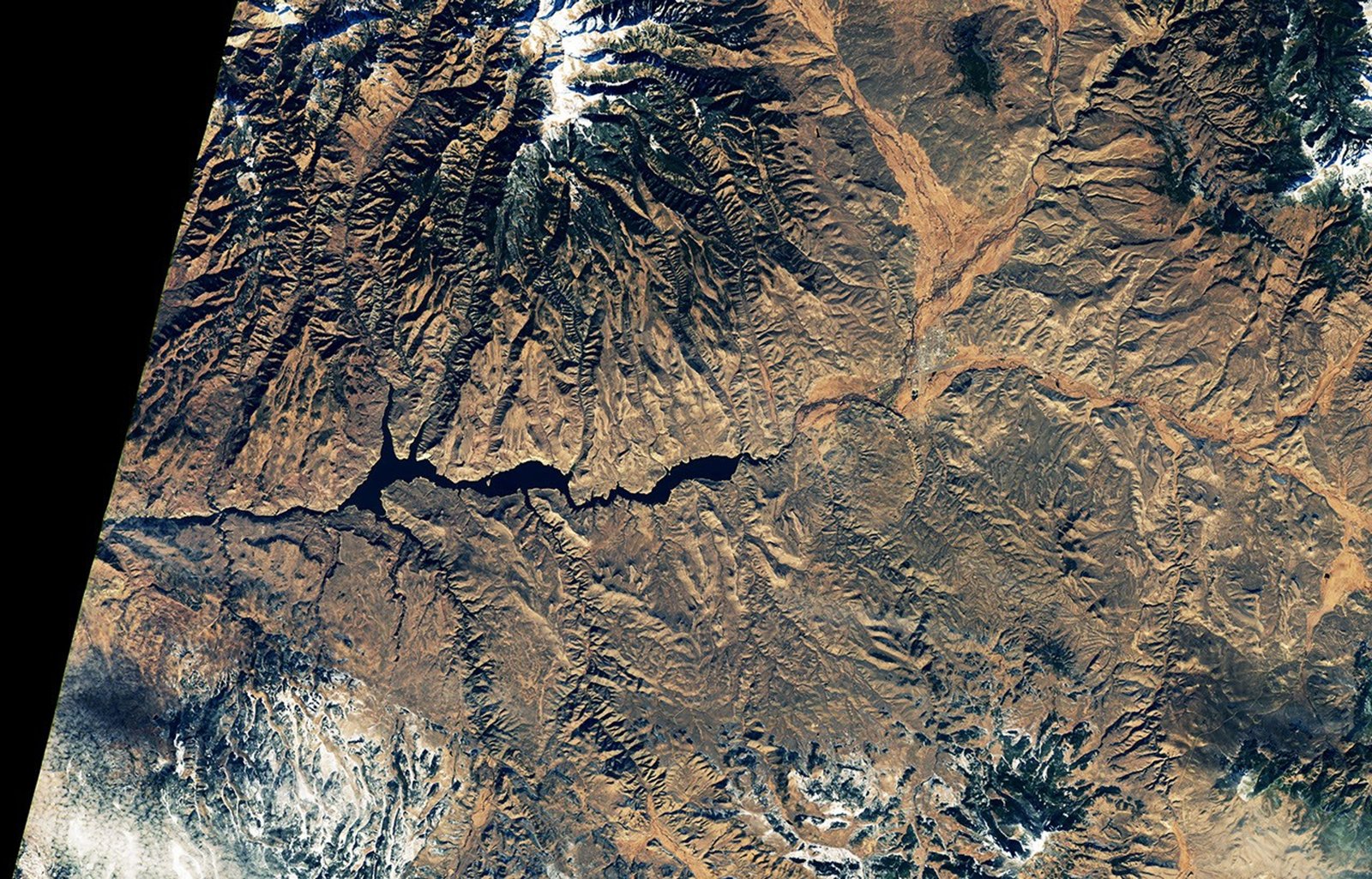
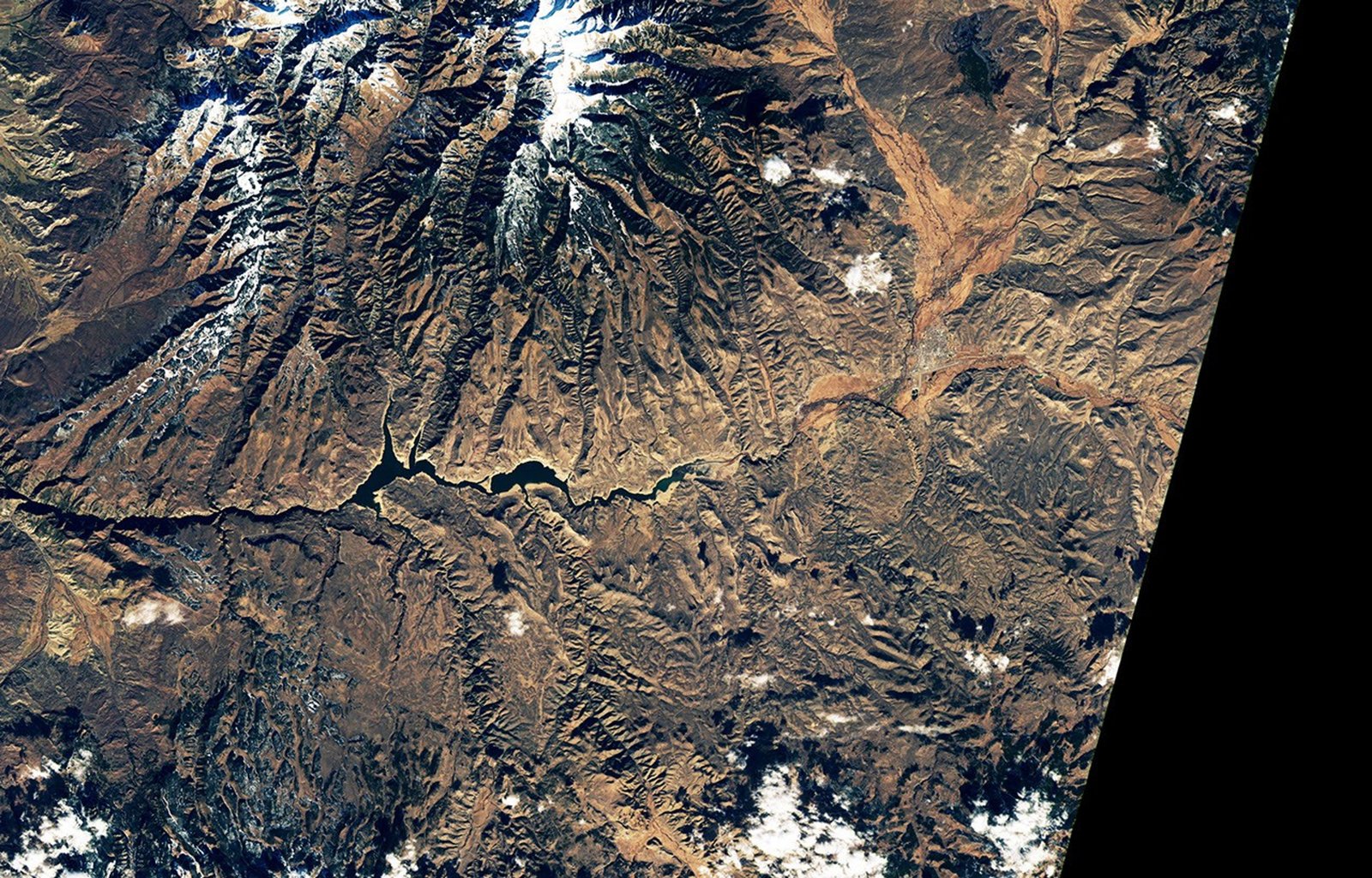
The summers of 2021 and 2022 were difficult seasons for Colorado’s Blue Mesa Reservoir. A severe drought hit much of the western U.S., prompting emergency water releases that brought the reservoir to its lowest level since 1984. Marinas and boat ramps closed, the remains of a ghost town emerged from the mud, and parts of
The summers of 2021 and 2022 were difficult seasons for Colorado’s Blue Mesa Reservoir. A severe drought hit much of the western U.S., prompting emergency water releases that brought the reservoir to its lowest level since 1984. Marinas and boat ramps closed, the remains of a ghost town emerged from the mud, and parts of the reservoir turned greenish and swirled with blooms of toxic cyanobacteria.
Research by scientists from the U.S. Geological Survey and the National Park Service analyzed decades of data from Blue Mesa Reservoir and found a connection between low water levels, warm water temperatures and harmful blooms.
“Algal blooms were most common when water levels were below 7,470 feet and water temperatures were above about 19.5 degrees Celsius (67.1 degrees Fahrenheit),” said Tyler King, a research hydrologist with the U.S. Geological Survey. Water levels this low are relatively common and have occurred every few years in recent decades.
While some cyanobacteria, also called blue-green algae, are always present in the reservoir in small quantities, problems arise when certain types proliferate. Afanizomenon, Dolichospermand WoronichiniaFor example, they thrive when reservoir waters warm and stagnate, releasing a toxin called microcystin that can cause skin and eye irritation, respiratory problems, and liver damage. Children and pets are particularly vulnerable to microcystin poisoning due to their size and tendency to ingest more water than adults.
King and his colleagues analyzed in situ water samples and satellite observations from the European Space Agency’s Sentinel-2 mission and the NASA/U.S. Geological Survey Landsat satellites. A Sentinel-2 sensor that detects chlorophyll, the light-harvesting pigment, was particularly useful for mapping blooms, while Landsat sensors were used to map water temperatures over time.
The National Park Service and the U.S. Geological Survey launched the project in 2021 after anecdotal reports and water sampling suggested elevated concentrations of cyanobacteria, King said. Scientists collected water samples, but also turned to historical records and satellite data, “like a time machine,” he said, to examine conditions before regular water sampling began. Their analysis included satellite records of chlorophyll levels dating back to 2016 and temperature records dating back to 2000. The research team also studied in situ data on water levels dating back to the 1970s.
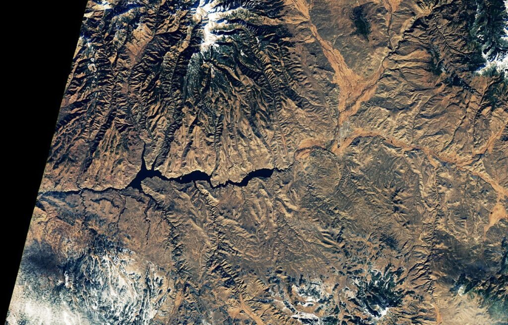
Satellite data showed that blooms generally begin at the eastern end of the reservoir, an area known as the Iola Basin. The basin, where the Gunnison River empties into the reservoir, is the shallowest part of the reservoir. Occasionally, satellite data showed, the blooms extended westward toward other parts of the reservoir, sometimes moving about two-thirds of the way. However, toxin concentrations rarely reached levels that posed health concerns beyond the Iola Basin.
The same dynamics that caused challenges for Blue Mesa in 2021 and 2022 are present in 2026, King said. Drought is once again hitting much of the western United States, the mountains have little snow and water levels on Blue Mesa are low. On June 27, 2026, the reservoir stored about 43 percent of the water it normally stores on that date, the lowest value observed for that day in the last 30 years. Water levels are expected to continue declining through October, according to projections from the U.S. Bureau of Reclamation.
If cyanobacteria blooms emerge in 2026, researchers hope satellites will help scientists track them. Researchers use the U.S. Geological Survey’s WaterMAP (Water Monitoring Over the Planet) tool to monitor potential bloom conditions within hours of satellite flyovers. NASA’s STREAM (Satellite-Based Tool for Rapid Assessment of Aquatic Environments) project also uses data from Landsat and Sentinel-2 to map potential blooms within hours of a satellite overpass, and the multi-agency CyAN (Cyanobacteria Assessment Network) project collects daily data from other satellites to map blooms in larger bodies of water.
“It’s amazing that we can use satellites to map the impacts of microscopic organisms from almost 500 miles away,” King said. However, it will still be crucial for people to get out on the water to take samples and perform direct testing for toxins, he emphasized. “Satellites are not definitive,” he added. “They can tell us where there are could be a problem, but toxins are often not present until the late stages of flowering.
NASA Earth Observatory images taken by Michala Garrison, using Landsat data from the US Geological Survey. Photos by Katie Walton-Day (USGS) and Nicole Gibney (NPS). Story by Adam Voiland.
- Aspen Journalism (January 9, 2026) Low reservoir levels are the main cause of toxic algae on Blue Mesa. Accessed July 1, 2026.
- Aspen Journalism (September 4, 2021) Blue Mesa Reservoir releases to shore up recreation impacting Lake Powell. Accessed July 1, 2026.
- CPR News (September 3, 2021) Drought-stricken Blue Mesa Reservoir loses 8 feet of water to save Lake Powell. Accessed July 1, 2026.
- The Colorado Sun (2023, June 16) Side-by-side photos show how much Blue Mesa Reservoir water levels have risen thanks to this winter’s snow. Accessed July 1, 2026.
- The Colorado Sun (2022, September 22) At Colorado’s largest reservoir, a national park scientist focuses her attention on toxic algae. Accessed July 1, 2026.
- Environmental Protection Agency (2026, January 5) Cyanotoxins (microcystin). Accessed May 28, 2026.
- king, television, et al. (2025) Remote sensing of chlorophyll a and temperature to support algal bloom monitoring in Blue Mesa Reservoir, Colorado. JAWRA Magazine of the American Water Resources Association, 61(4), e70038.
- National Park Service reservoir levels (2026). Accessed July 1, 2026.
- U.S. Bureau of Reclamation (2026) Blue Mesa Reservoir. Accessed July 1, 2026.
- US Bureau of Reclamation (2026) Deposit Storage Dashboard. Accessed July 1, 2026.
- University of Colorado Boulder (January 26, 2026) Low reservoir levels are the main cause of toxic algae on Blue Mesa. Accessed May 28, 2026.
- US Drought Monitor (May 28, 2026) Colorado. Accessed July 1, 2026.
- Walton-Day, K., et al. (2025) Environmental characterization of Blue Mesa Reservoir and potential causes and management strategies of harmful algal blooms, 1970 to 2023, Curecanti National Recreation Area, Colorado. U.S. Geological Survey Scientific Research Report, 2025–5109.
Keep following us for the latest insights.