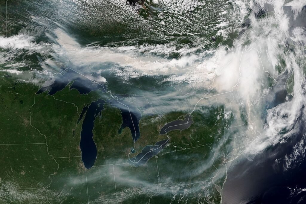
After a slow start to Canada’s 2026 fire season, activity rebounded in late June amid dry, warm conditions and moved back closer to the 25-year average. As of mid-July, nearly 850 fires were actively burning across the country, according to the Canadian Interagency Wildfire Centre. More than 180 of them burned in Ontario. This NOAA-21
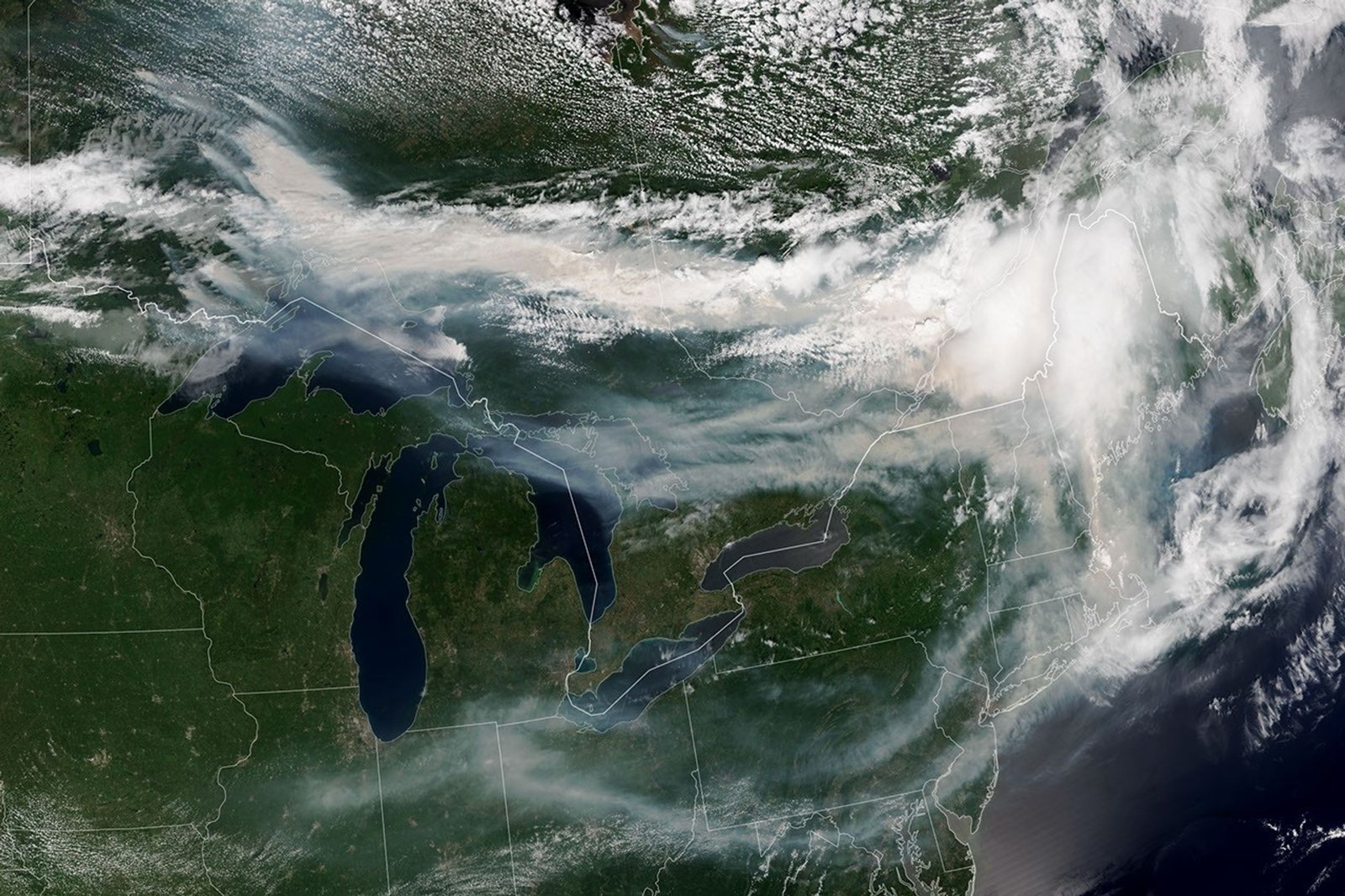
After a slow start to Canada’s 2026 fire season, activity rebounded in late June amid dry, warm conditions and moved back closer to the 25-year average. As of mid-July, nearly 850 fires were actively burning across the country, according to the Canadian Interagency Wildfire Centre. More than 180 of them burned in Ontario.
This NOAA-21 image, acquired on the afternoon of July 14, 2026, shows smoke billowing from the Ontario fires. The winds carried the smoke mainly southeast over much of the southern part of the province, as well as parts of Quebec and the Midwest and Northeast US, turning the sky shades of gray and yellow and the sun orange in many areas.
The impact of smoke on air quality varied, depending largely on altitude. In areas where smoke was high in the atmosphere, impacts on air quality were negligible; Where it approached the ground, conditions worsened. Air quality in Toronto, for example, reached unhealthy levels, according to AirNow. Residents in the south of the province were also dealing with a heat wave, compounding health risks.
Much of the smoke came from fires in northwestern Ontario, where eight fires experienced significant growth on July 13 and 14. The fires led officials to issue evacuation orders for several communities in this part of the province, according to news reports.
As of July 14, fires across Canada have burned 1.9 million hectares (4.7 million acres) since the beginning of the year, still well below the season totals from the extreme fire years of 2023 and 2025. How the rest of the season will play out remains to be seen. A seasonal fire outlook, compiled by wildfire experts from the U.S., Canada and Mexico, shows where fire conditions are most or least likely during July, August and September.
NASA Earth Observatory image by Lauren Dauphin, using VIIRS data from NASA EOSDIS LANCE, GIBS/Worldview, and the Joint Polar Satellite System (JPSS). Story by Kathryn Hansen.
- AirNow (2026, July 15) Wildfires. Accessed July 15, 2026.
- CBC (2026, July 15) Heat and smoke from wildfires combine to create dangerous conditions across southwestern Ontario. Accessed July 15, 2026.
- Ministry of Natural Resources, Ontario (2026, July 14) Wildfires. Accessed July 15, 2026.
- National Interagency Fire Centre, Natural Resources Canada and National Weather Service (2026, July 14) North American Seasonal Fire Assessment and Outlook. Accessed July 15, 2026.
- The New York Times (2026, July 15) Toronto under orange skies as wildfire smoke reaches northeastern US. Retrieved July 15, 2026.
- Reuters (2026, July 15) Smoke from Canadian wildfires chokes Toronto and threatens American cities. Accessed July 15, 2026.
Check back often for more exciting news!